
Maricopa ZIP Directory Coverage
Three Census ZIP Code Tabulation Areas, or ZCTAs, are fully or partly contained in Maricopa. ZCTAs approximate groups of Maricopa delivery addresses for statistics. They do not reproduce USPS routes or the incorporated boundary. The coverage table therefore identifies the practical postal role of each code and flags where a Maricopa parcel check is still needed.
| ZIP | Areas Covered | Post Office | Notes |
|---|---|---|---|
| 85138 | Principal Maricopa delivery and ZCTA, partly or wholly in the city | Maricopa Carrier Annex, 40435 W Honeycutt Rd | Changed from 85238 in 2009; 8,489 deliveries cited |
| 85139 | Principal Maricopa delivery, not coextensive with city limits | Maricopa Post Office, 44920 W Hathaway | Changed from 85239 in 2009; 5,538 deliveries; boxes and general delivery |
| 85172 | ZCTA partly contained in Maricopa, chiefly tied to Stanfield | Stanfield Post Office, 36840 W Highway 84 | Verify every parcel; exact overlap streets were not established |
Start a Maricopa ZIP code directory search with the USPS city and state lookup. It verifies delivery information rather than municipal status.
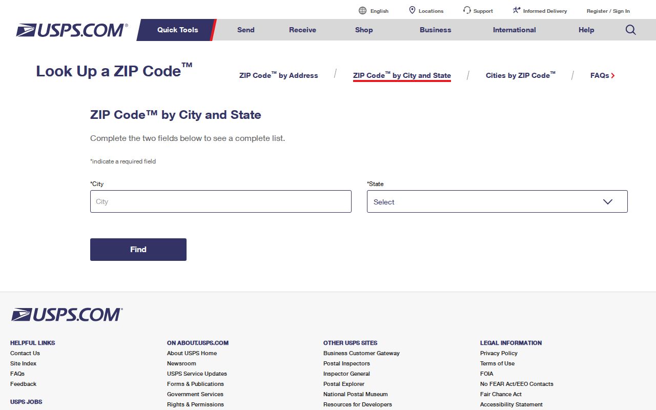
The USPS screen supplies the postal starting point. A second city or county check is still needed before routing a permit, deed, or parcel question.
Maricopa Postal Codes Changed
USPS changed Maricopa's 85238 and 85239 codes to 85138 and 85139 in 2009. The Maricopa street did not move. The middle digit changed as part of a broader Arizona conversion, making the event a key bridge for old Maricopa phone books, school records, deeds, news notices, and family papers.
The official USPS Arizona conversion notice documents the change and its July 2009 context.
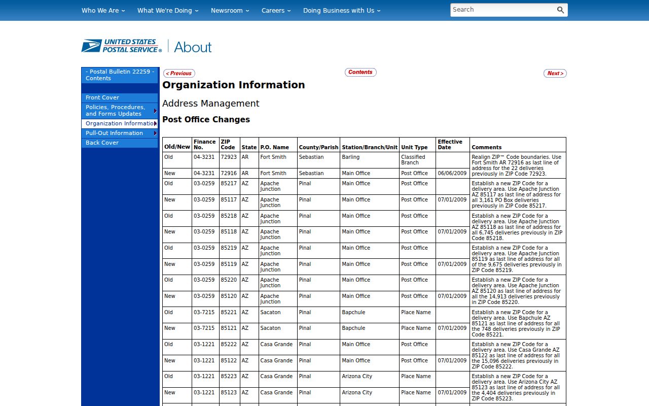
The notice gives researchers a firm continuity rule: test 85238 or 85239 before the conversion, then 85138 or 85139 after it. Search both around the transition because databases and copied forms may retain an older code.
Maricopa ZIP and City Limits
Postal Maricopa and incorporated Maricopa are different geographies. The Maricopa Addressing app accepts an address and returns “City Limits” or “Not Within City Limits.” That result tells a researcher whether a current Maricopa permit or code request belongs at City Hall. Pinal County GIS and parcel records provide the county layer. A current answer does not settle whether land was inside Maricopa on an older event date because annexation can change the line.
The Census explains that ZCTAs are statistical areas built from census blocks and address data.
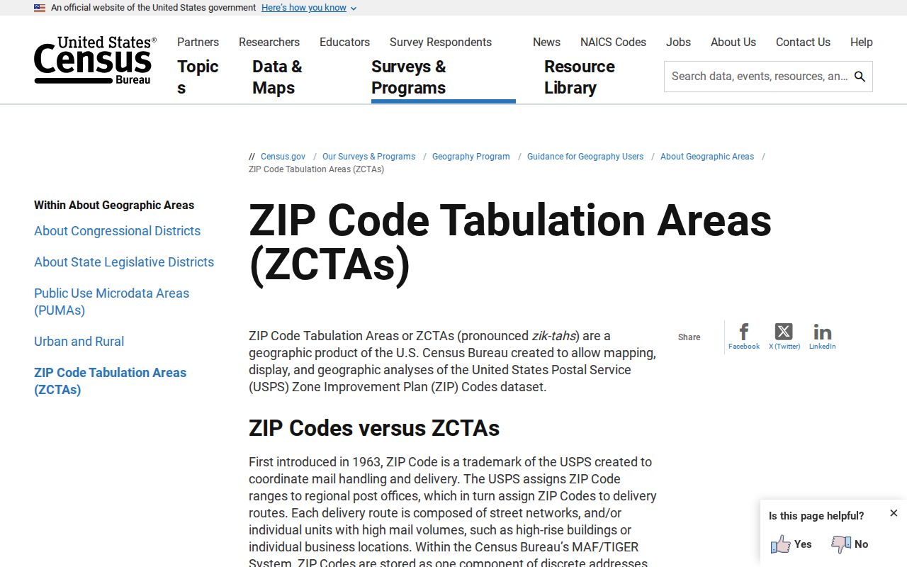
The distinction explains why a ZCTA profile cannot be used as a postal route map, legal boundary, or resident roster. For record routing, combine postal verification with the city limit tool and parcel map.
- Postal code
- A USPS code used to sort and deliver mail.
- ZIP+4
- A nine-digit delivery refinement for a smaller address segment.
- ZCTA
- A Census statistical approximation of a ZIP delivery area.
- PO-box ZIP
- A code or use tied to post-office boxes rather than street delivery.
- Carrier route
- A group of addresses served in a postal carrier's delivery sequence.
Maricopa ZIP 85138
85138 is a principal Maricopa delivery code and includes many Maricopa civic addresses. Its cited facility is the Maricopa Carrier Annex at 40435 W Honeycutt Road. The research cites 8,489 deliveries at the time of the 2009 conversion material. The Maricopa delivery count is historical postal context, not a household total and not a current population count.
Use 85138 to verify mail addressing and locate Census statistics, then move to an APN or standardized situs address for land records. Situs means the parcel's physical location. It may differ from the postal address where the owner receives tax mail. That difference is normal and must not be read as proof of who occupies the parcel.
Note: A Maricopa last line does not by itself show that an address is inside the incorporated city or subject to city records.
Maricopa ZIP 85139
85139 is another principal Maricopa delivery code. The retail Maricopa Post Office is at 44920 W Hathaway and is listed at 520-568-2641. The Maricopa office handles general delivery and boxes. The 2009 source cites 5,538 deliveries, again as a period count rather than a resident tally.
The ZIP is not coextensive with Maricopa city limits. When an 85139 address appears in a property, permit, school, or family record, verify the parcel and jurisdiction instead of assuming the city is the custodian. Use the city addressing result for current municipal status and Pinal County systems for parcel, tax, and recorded-instrument evidence.
Maricopa ZIP 85172 Overlap
85172 demonstrates the boundary problem in the other direction. Its preferred postal city is chiefly Stanfield, yet the Census identifies its ZCTA as partly contained in Maricopa. A Stanfield postal label therefore does not prove that a parcel lies outside Maricopa's incorporated area.
The exact overlap streets were not established in the research. Do not draw a hard local line from the ZIP alone. Verify the full address with USPS, run the City of Maricopa limit check, inspect the parcel in Pinal GIS, and save the APN and legal description. That sequence turns a broad postal clue into a record-ready location.
Find Maricopa Residents by ZIP
A postal directory can narrow a large set, but official portals do not offer one open roster of everyone living inside a code. The assessor has no dedicated situs-ZIP field. The Pinal Treasurer accepts a ZIP in its owner mailing-address search. Those results describe where tax correspondence goes, so they may include land outside Maricopa owned by someone receiving mail here and omit local land owned from elsewhere.
| Field | Portal | What It Filters | Important Limit |
|---|---|---|---|
| ZIP | Pinal Treasurer Parcel Search | Owner mailing address | Not parcel situs ZIP |
| Owner | Pinal Treasurer or Assessor | Assessment or tax-roll name | Owner is not always occupant |
| Property address | Pinal Assessor | Parcel situs | No dedicated ZIP-wide situs filter |
| Address, APN, owner | Pinal GIS | Mapped parcel | GIS is informational, not a legal survey |
- Verify the full delivery ZIP with USPS, including ZIP+4 when available.
- Check whether the address is inside Maricopa's current city limit.
- Open Pinal GIS by address or APN and confirm the parcel polygon.
- Use the assessor for situs and ownership, keeping postal and physical addresses separate.
- Use the recorder's legal description when the question depends on title or historical land identity.
Once the ZIP has narrowed the search to a known road or parcel, the Maricopa street directory provides the address-level workflow.
Maricopa ZIP Growth Context
Maricopa grew from 43,482 residents in 2010 to 58,125 in 2020 and an estimated 78,362 on July 1, 2025. That fast growth helps explain why a directory result, ZCTA statistic, or mailing file must carry a date. It also increases the chance that city development and postal geography will shift at different speeds.
The city's population and demographics source places the city at about 43 square miles within a much larger 233-square-mile planning area.
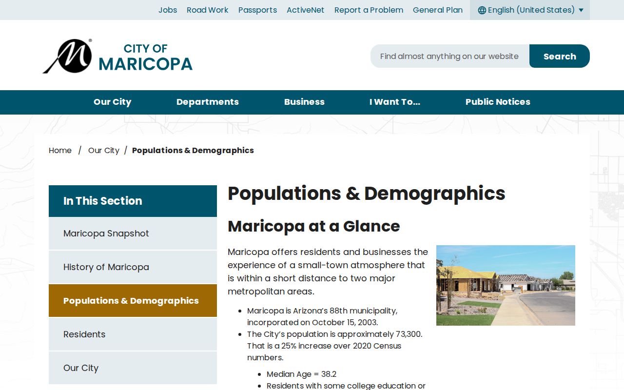
The scale difference is another warning against treating “Maricopa” as one universal boundary. Postal, planning, school, voting, tax, and incorporated geographies can overlap without matching.
Route Maricopa ZIP Records
Use the ZIP only as the opening clue. City Hall keeps city permits, code matters, and municipal records for land within its jurisdiction. Pinal County keeps the assessor, treasurer, GIS, recorder, superior-court, and voter systems. USPS controls delivery coding, while the Census publishes ZCTAs for statistics.
Voter information adds another limit. Arizona's individual portal verifies a voter's own registration with identifying inputs. Pinal County voter data requests use a statutory form, permitted-purpose certification, and a chosen geographic scope. No official arbitrary ZIP-wide name browser was found. Protected addresses and restricted identifiers remain withheld.
Access also changes with the record type. A current parcel can be checked online through the assessor, treasurer, and GIS tools. A recorded title question moves from the parcel's APN and legal description into the Recorder index, with certified copies ordered from that office. A city-limit result directs current permit and code questions either to Maricopa's JustFOIA route or to the proper Pinal County department. Older address evidence may require a library, the Historical Society, Arizona Memory, or the State Archives because no verified Maricopa-specific reverse-directory run is posted online. Each fallback keeps the ZIP as context while switching to a stronger identifier.
A precise request should state the record class, custodian, full address, APN when known, date range, and whether inspection or a copy is wanted. Do not ask an office to identify every person in a ZIP. Narrow record requests fit Arizona's prompt-access standard and reduce the risk of confusing mailing geography with a household.
Note: A ZIP search miss may call for an old code, a different custodian, or an APN; it does not prove that no record exists.